
Software
Sat-LiDAR
Point clouds in. Engineering out.
A comprehensive, user-friendly solution for managing and processing airborne and SLAM LiDAR data — automated workflow, enhanced visualization and advanced engineering tools.
 1 / 4


Airborne and SLAM, one workflow.
Apus-series airborne data gets coordinate transformation, strip optimization and quality control through to DOM orthophotos; handheld SLAM data gets one-click filtering, georeferencing and colourization.
3DGS, in real time.
Generate realistic, immersive 3D scenes from SLAM data with smooth visualization — backed by RTK / PPK / GCP fusion that sharpens trajectories in GNSS-challenged environments.
Terrain and AEC deliverables.
Automatic ground/non-ground classification, DEMs, contours, elevation points and volume reports for terrain work; slicing, unfolding, section extraction and comparison tools for architecture and engineering.
In detail.
Sat-LiDAR provides a comprehensive and user-friendly solution for managing and processing airborne and SLAM LiDAR data. The software delivers high-precision, high-quality results through an automated workflow, enhanced visualization, and advanced engineering tools.
Airborne Module — For Apus Series Data Processing
From coordinate transformation to strip optimization and quality control. Deliver high-quality point clouds and DOM orthophotos with confidence.
SLAM Module — For Handheld SLAM Data Processing
Real-time 3DGS Reconstruction: Generate realistic, immersive 3D scenes from SLAM data with smooth visualization. One-Click SLAM Processing: Automatic filtering, georeferencing, and colourization. Global Coordinate Compatibility: Supports worldwide coordinate systems and Geoid models. RTK / PPK / GCPs Fusion: Enhances trajectory accuracy in GNSS-challenged environments.
Terrain Module
Automatic Classification: Automatically classifies point clouds into ground and non-ground. DEM Generation: Automatically generates Digital Elevation Models from point cloud data. Contours & Elevation Points: Produces detailed topographic outputs. Volume Measurement: Calculates and reports single and multiple volumes.
AEC Module (Architecture, Engineering and Construction)
Architecture Module: Effortless point cloud slicing and unfolding for seamless CAD geometry assistance. Engineering Module: Extracts sections, visualizes complex structures, and provides volume measurement, comparison, and reporting tools.
Applications
- Airborne Mapping
- Mobile SLAM Mapping
- Engineering Analysis
- 3DGS Visualization
Tech Specs
- Modules
- Airborne, SLAM, Terrain and AEC
- SLAM processing
- One-click filtering, georeferencing and colourization; real-time 3DGS reconstruction
- Fusion
- RTK / PPK / GCP fusion
- Terrain outputs
- DEM generation, contours, elevation points and volume measurement
- Compatibility
- Worldwide coordinate systems and geoid models
Keep exploring.

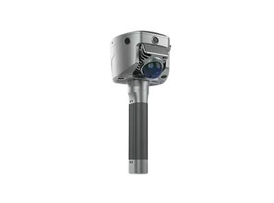
See the Sat-LiDAR on your own site.
The fastest way to judge it is in your own field conditions. Book a demo and our team will bring it to you — or ask about rentals.