
LiDAR
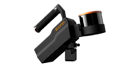
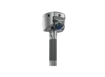
Cygnus 3
Everything. One.
LiDAR, three true-colour cameras, RTK/PPK positioning and advanced SLAM — one integrated scanner for the sites that break ordinary workflows.
 1 / 2

Indoor to outdoor. One walk.
Adaptive scene collection carries a single scan from interiors through GNSS-challenged zones to open sky. RTK-assisted SLAM frees you from conventional closed-loop paths and keeps positional consistency across the whole route.

Know it's good. Before you leave.
Real-time point cloud preview, live colourized visualization, a route-based accuracy heatmap and the breathing LED accuracy indicator show data quality on site — less guesswork, less rework, no missed coverage discovered back at the office.

One scan. Many deliverables.
Handheld, backpack, car-mounted or UAV-mounted in the field; then the Sat-LiDAR workflow turns one dataset into colourized point clouds, mesh models and 3DGS outputs — with wizard-based auto filtering, colourization and geo-referencing.

In detail.
Cygnus 3 is built for complex indoor, outdoor, and GNSS-challenged environments. It combines LiDAR, vision, RTK positioning, and advanced SLAM algorithms to deliver reliable 3D data for surveying, construction, infrastructure, and digital twin workflows.

Integrated RTK
Built-in RTK for globally consistent point cloud results.
Accuracy Heatmap
Check data quality directly during field scanning.
Multi-Platform Mapping
Handheld, backpack, vehicle, and UAV operation.
Rich Deliverables
Point clouds, mesh, 3DGS, and engineering outputs.
Key Features
Industry-Leading SLAM with Integrated RTK
- Advanced SLAM algorithms for complex environments
- RTK / PPK / GCP-supported workflows
- Improved coordinate consistency
- Clean setup with fewer external accessories

Real-Time Data Confidence
- Real-time point cloud preview
- Accuracy heatmap feedback
- Resume scanning support
- Verify data quality on site

Multiple Output Forms
- High-Accuracy Point Clouds — Engineering-grade geometry for surveying and analysis
- Mesh Surface Models — Structured surfaces for inspection, visualization, and measurements
- 3DGS Reconstruction & Visualization — Visual representations for presentation, communication, and digital twins

Flexible Operation Modes

- Handheld Mode
- Backpack Mode
- Vehicle-Mounted Mode
- UAV-Mounted Mode
Sat-LiDAR Software Workflow
From SLAM Data to Engineering Deliverables
Cygnus 3 works with Sat-LiDAR to connect field scanning, SLAM processing, correction, analysis, visualization, and deliverable preparation in one workflow. Users can move from raw scan data to engineering-ready outputs without breaking the workflow.

Sat-LiDAR Software Workflow & Ecosystem
Import
Cygnus 3 raw scan data
Process
Optimize, correct and georeference
Analyze
Measure, section and calculate
Deliver
Generate final deliverables
Process & Correct
Convert Cygnus 3 raw scan data into optimized, georeferenced, and colorized point clouds.
- SLAM processing and optimization
- Colorized point cloud generation
- Coordinate transformation and georeferencing
- RTK / PPK / GCP-supported correction
- Accuracy check and data adjustment
Analyze & Deliver
Turn processed data into engineering, visualization, and digital twin deliverables.
- DEM, contours, sections, and profiles
- Volume measurement and engineering analysis
- Mesh and 3DGS visualization
- CAD / BIM reference data output
Application Scenarios

Urban Mapping

Infrastructure & Corridors

Industrial Facilities

Architecture & Construction

Digital Twins & Visualization

Emergency Response & Rapid Mapping
Applications
- Urban Mapping
- Infrastructure & Corridors
- Industrial Facilities
- Architecture & Construction
- Digital Twins & Visualization
- Emergency Response & Rapid Mapping
The full brochure.
PDF Download the full brochureCygnus 3 Brochure DownloadTech Specs
- Sensor Suite
- LiDAR + vision + advanced SLAM, fully integrated in one compact system
- Cameras
- 3× true-color cameras
- Positioning
- RTK/PPK — built-in GNSS antenna and cellular module
- Field Feedback
- Real-time point cloud preview, live colorization, route accuracy heatmap, LED accuracy indicator
- Mounting Options
- Handheld, backpack, car-mounted, UAV-mounted
- Outputs
- Colorized point clouds, mesh models and 3DGS via the SatLiDAR workflow
Keep exploring.

See the Cygnus 3 on your own site.
The fastest way to judge it is in your own field conditions. Book a demo and our team will bring it to you — or ask about rentals.